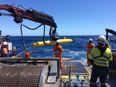
In 2016, MMA completed an AUV project for Woodside on the North West Shelf of Western Australia.
The AUV is programmed on deck to undertake a survey mission using its payload sensors of Multibeam Echosounder and Sidescan sonar, its positioning is determined using Inertial Navigation systems which are ‘aided’ with USBL positioning from the vessel on the surface. The AUV was able to complete missions of up to 28 hours of continuous survey at which point batteries were depleted. At this point the AUV is recovered to surface, batteries are swapped with a freshly charged set, data is downloaded to the vessel server, and the process begins again.
Due to the fact the AUV is operating in deep water close to the seabed, the data quality and resolution is much higher than surface or towed sensors due to the reduced travel time for sonar, and the decoupling of the sensor package from the vessel motion and noise.
- Total survey area in the scope was 31km2, with a total of 629 line km surveyed, over a period of 20 days.
- Crew of 10 on board from MMA, including 2 from Bluefin Robotics.
- Zero incidents